The plan was to operate on Buffalo Ridge for Saturday and near Fargo, ND on Sunday. Buffalo Ridge runs from Iowa to far northeastern SD. For the August weekend, we had Holly KØHAC, Chris NØUK, Donn WA2VOI and Bruce W9FZ. We convened on Friday night in Pipestone, MN. We found a motel that met the minimum. Donn and I had a slow drive on a beautiful Friday afternoon out from the cities. We ragchewed periodically on 2m and stopped at a Rail Museum in a small town just prior to closing. Friday was SO nice--but we knew the forecast for Saturday was bad.
Sure enough, we woke to rain. We went to our first location near Lake Wilson, MN and caught a break in the rain. The rain had not yet arrived in the Twin Cities so there were a few guys ready to work us. Well, the rain came rolling in and shut us down and we got back on the road. We talked via cellphone with KM0T and others with radar images and the rain looked pretty solid. So we skipped several spots we had previously hoped to activate. We slowly dried out in our cars.
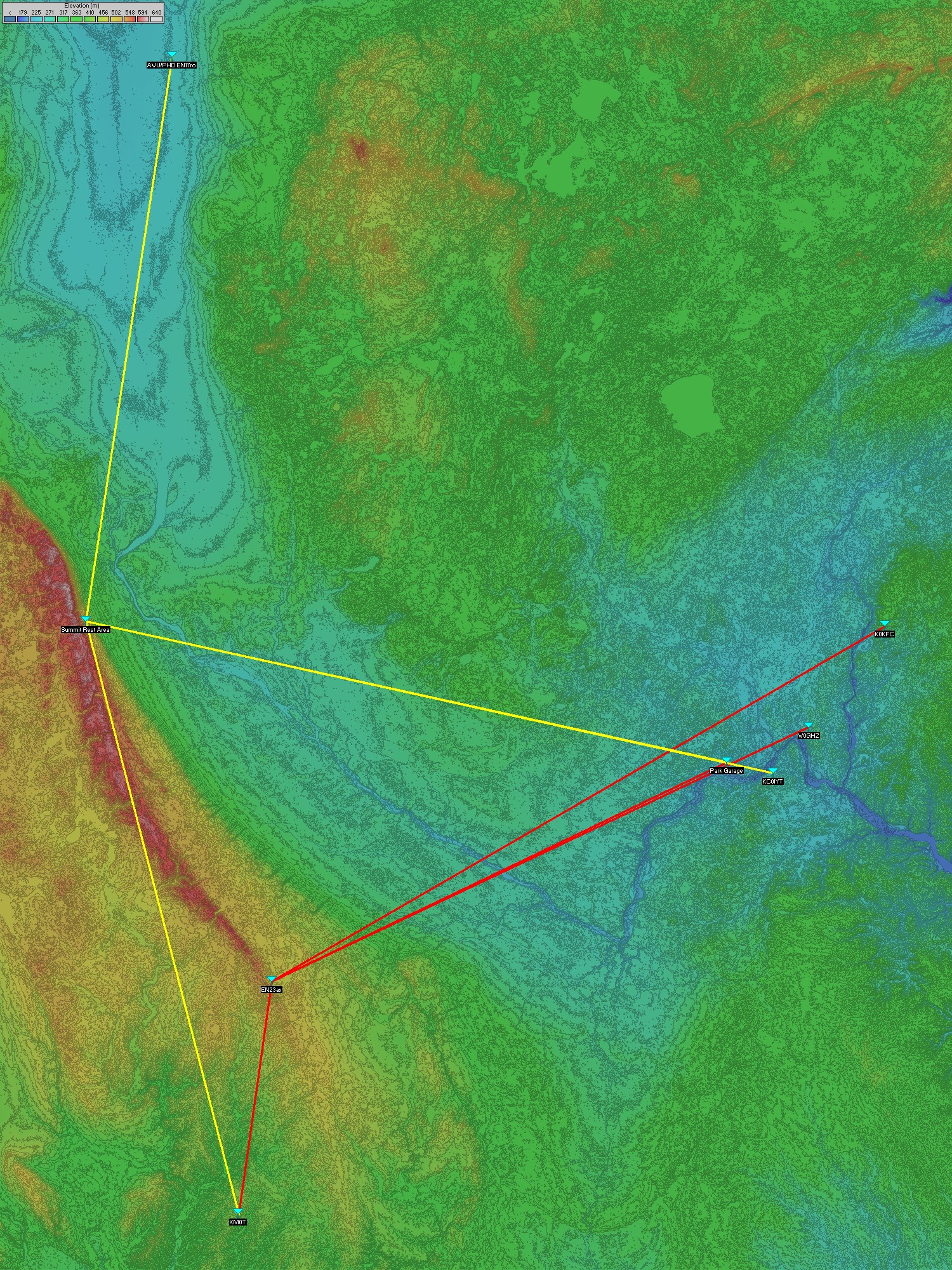
As we neared Summit, SD on I-29, we noted that although it was foggy, the rain seemed to have stopped. So we whipped into the rest area (one of our planned spots) and worked the Twin Cities (who were now getting wet), KMØT, and both Wally WØPHD and Bill KØAWU who were operating portable north of Fargo on the Minnesota side.
Then the rain started again. (Notice a trend here?) We set off northward. Radar reports showed clear at Fargo, ND. In fact, the radar showed no precip 70 miles south of Fargo. Well, we assumed we'd get to Fargo, operate once and then go to our motel. Despite what the radar showed, we can confirm rain all the way to Fargo. We never did operate again on Saturday--just the two spots.
We had a little trouble finding motel rooms on account of "new student week" at the local University. Once we got rooms, we headed out for food. We found a great East Indian restaurant. We had fine conversation over dinner. We went back to the motel and noted that the forecast for Sunday was.............more rain.
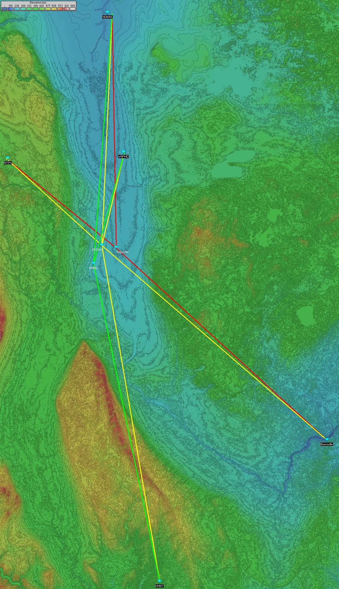
For Day 2, we met for breakfast in the lobby of our hotel. We intended to be out the door at 7:45am but we actually sat there until 9am just chatting and monitoring the weather. So we loaded up and headed out north of Fargo to the Argusville exit. It wasn't raining--yet.
We just headed east of Argusville about a mile and found a clear spot with views towards Winnipeg, Devils Lake, and the Twin Cities. We worked Dennis NTØV, and Barry VE4MA. We called the Twin Cities on the cellphone to see where and how they were. There were gaps in the rain in the Twin Cities and some operators were at a clear spot in Burnsville. We proceeded to run with them and there they were! Signals improved to the point where SSB exchanges were possible.
For our second location, we moved about 12 miles west. Since the Twin Cities guys were starting to get rained on, we promised them we'd work them first. Fortunately, the paths were good enough to hook up again. Here, we again worked NTØV, VE4MA, and KMØT. Now Wally WØPHD was on the air from Warren, MN.
For our third location, we moved about 18 miles south to just outside Casselton, ND. We picked up Wally WØPHD, Barry VE4MA, and Mike KMØT. It started to rain again. We realized that this was the end of operating if it was going to rain.
So we got underway on the interstate back to the Twin Cities and we drove through rain nearly the entire way. We whipped off the interstate near Rogers, MN to operate from Fletcher, MN where there is a view of downtown. We worked the locals again for some more q's.
In over 17 years of roving, W9FZ has NEVER had nann and Indian Curry as his snack food in the field! That's what's great about traveling with such nice people like WA2VOI, NØUK, and KØHAC. We had great conversations over dinner.
This year we went for a slower pace but more challenging distances. Thank you SO much to fixed stations who were patient through the long gaps between our operations. Thanks for being there! |